most na soci
Most na Soči bridge
Gorazd HUMAR
HISTORY
The Bridge That Gave Its Name to the Town.Historian Silvo Torkar’s research reveals the origin of the name Most na Soči, meaning “Bridge on the Soča”. His thorough examination of 14th-century documents uncovered explicit references to the construction of a bridge—the predecessor to the current one—that gave the settlement its name. In his research, Torkar established that this toponym consistently appeared in 17th and 18th-century sources as S. Maurus Pruck, Pons Sancti Mauri (St. Maurus Bridge), or simply Pons (Bridge).
Most na Soči is considered one of the most interesting archaeological sites in the southeastern Alpine region. Situated at the convergence of the Idrijca-Judrio and Soča-Isonzo rivers, the locality was nestled within a dramatic river loop that functioned as a natural defence system with formidable barriers throughout the ages. Given its advantageous position, the site emerged as a crucial crossroads for trade routes running through the Soča, Idrijca, and Bača valleys.
Archaeological excavations in the area have uncovered ancient settlements. While the earliest traces date to the Neolithic period, the most significant findings come from the early Iron Age (8th-4th century BC). These rich archaeological remains indicate a thriving settlement with substantial population and regional importance.
There are no reliable historical sources regarding the date of construction of the first masonry bridge at the site of the current road bridge, which stands before the entrance to Most na Soči. The location of today’s bridge was strategically chosen—it sits at the narrowest point of the Soča-Isonzo River’s glacial bed, where it extends to a depth of 27 metres and records particularly high flow rates during periods of heavy rainfall. Given these conditions, constructing a stone bridge in this area was only possible during the summer months, when the water levels were at their lowest.
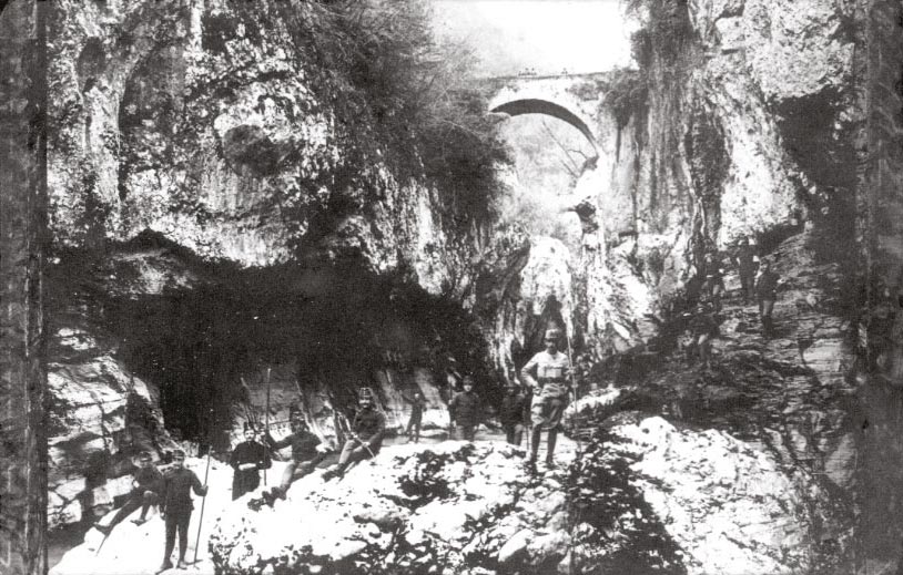
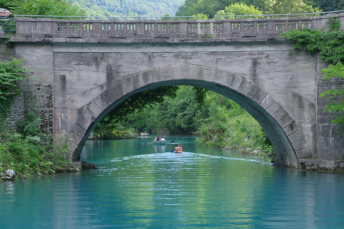
Photo by: Miljko Lesjak
BRIDGE CONSTRUCTION AND STRUCTURAL ENGINEERING
The most reliable sources of information regarding the Most na Soči bridge come from the Josephine military maps created between 1763 and 1787. From the period’s description of the Most na Soči bridge, we read:The masonry bridge, approximately 20 paces (about 15 m) in length, sits between particularly high, steep, and rocky riverbanks—characteristics that extend to the canal. The canal enables external passage across the bridge; in its absence, the current becomes very fast, and the riverbed, extremely rocky, is scattered with numerous rock fragments.
Over time, the bridge underwent several renovations and an expansion. Having survived World War I intact, it was widened to its current dimensions in 1943 for military purposes. The bridge features a single semicircular arch that rests on the steep banks of the Soča-Isonzo riverbed, spanning just over 14 metres with an arch width of 6.5 metres.
After the Doblar hydroelectric power plant was built on the Soča-Isonzo River in 1938, its reservoir flooded the area beneath the bridge, raising water levels to the arch foundations. During rainy periods and floods, the Soča-Isonzo’s waters rise to within one metre of the arch’s peak, leaving only a small section of the bridge visible above water.
Photo by: Miljko Lesjak
THE BRIDGE STANDS THE TEST OF TIME
The bridge itself is one of the most iconic landmarks of Most na Soči, making the Place immediately recognisable. Behind it, towards Tolmin, a vast artificial lake extends, lending additional charm to the structure over the Soča-Isonzo.In 1972, the bridge became the venue for the first edition of a diving competition that has become a cherished tradition. In 2008, it achieved international recognition by hosting the World Diving Championships. Athletes dive from a temporary tower that can rise up to 27 metres above the Soča-Isonzo River level.
In 2014, officials proposed replacing the historic bridge with a modern structure. However, the local community’s resolute opposition successfully safeguarded this engineering heritage, which continues to stand today.
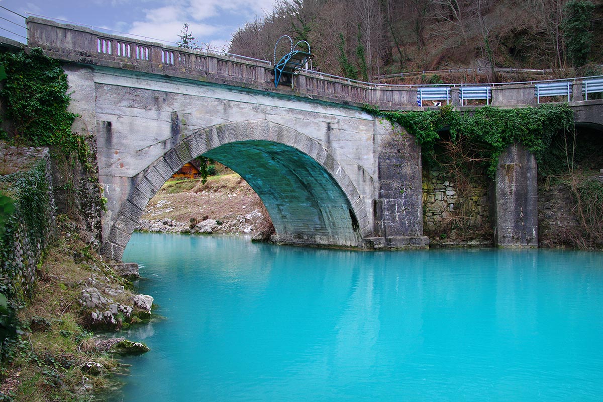
Photo by: Miljko Lesjak
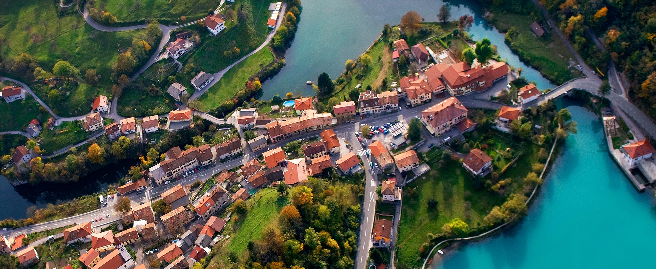
Photo by: Paolo Petrignani
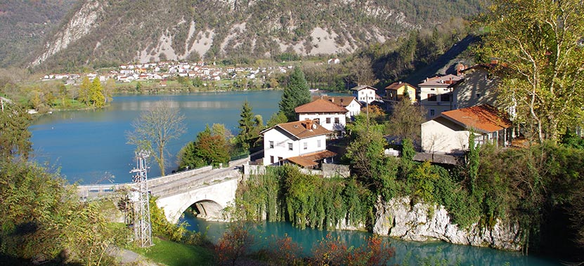
Photo by: Miljko Lesjak